SA-RIO-SW 01")


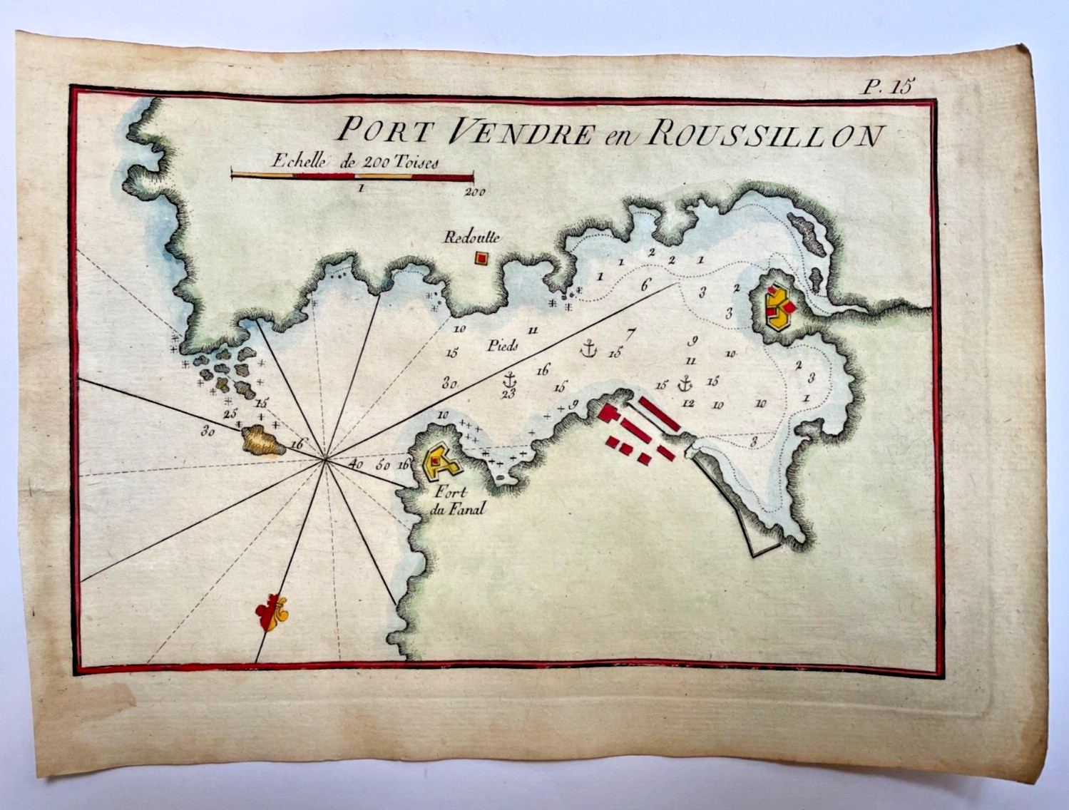
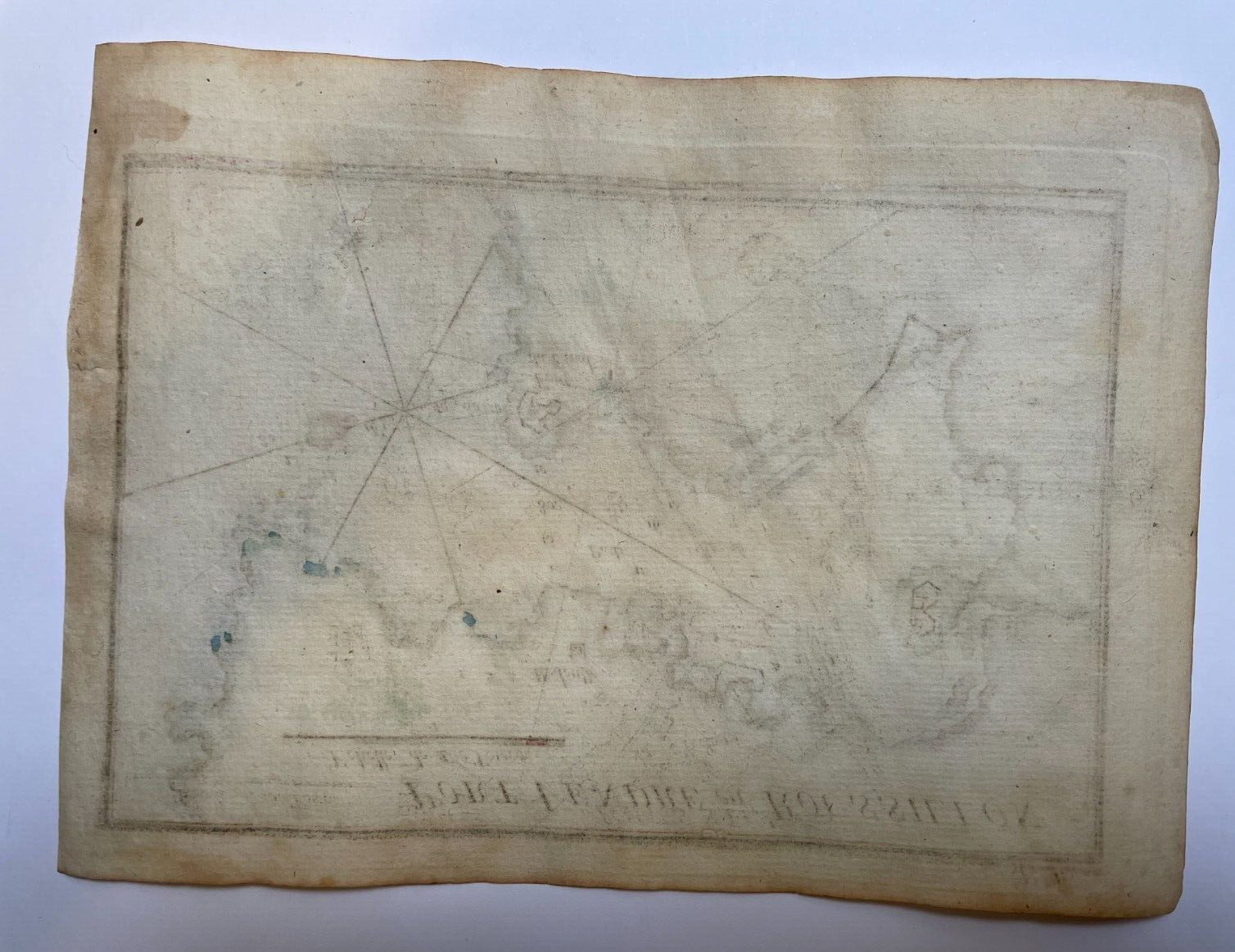
PORT VENDRE EN ROUSSILLON FRANCE 1764 JOSEPH ROUX ANTIQUE SEA CHART 18TH CENTURY
Check the listing for details.
| Location | Paris FR |
| Shipping | Free shipping (check listing for details) |
| Seller |
efi6
100.0% positive · 1705 feedback
|
| Listing | FixedPrice · Active |
| Start time | 2024-02-26T17:43:17.000Z |
| Date Range | 1700-1799 |
| Type | Nautical Map |
| Printing Technique | Copper Plate |
| Year | 1764 |
| Original/Reproduction | Antique Original |
| Country/Region | France |
Nice copper engraved sea chart of the rade of Port Vendre en Roussillon, France, by Joseph Roux (1725-1793).We can see the fortifications, topographical features, underwaters hazards and anchorages. Size with margins : 16 x 22 cm / 6,2 x 8,6 inchesCondition : very good condition, well engraved, handed colored.Edition : Marseille, 1764, 18th centuryWE DON'T SELL LASER AND COPIES MAPS, ALL WE SELL IS ORIGINAL AND ANTIQUEDue to the age an type of paper, some imperfections are to be expected. Please examine the images provided carefully, and if you have any questions please ask and we will be happy to help youIf you buy more than one item, you have to pay just one only shipping cost. We will send your item by Registered and Insured Airmail or by DHL with covering insurance. Customs may be charged on international shipments. All customs charges are the responsiblity of the buyer and are not included in the selling price. A Certification of Authenticity can be issued on request.View our FeedbackVisit our eBay StoreAdd us to your Favorite Sellers